
eThekwini AI disaster management: what it could change for residents
eThekwini AI disaster management would mean using software to help the city spot risk faster, sort reports and push warnings sooner, but only if the municipality confirms the system is live. For residents, the real question isn’t whether AI sounds modern, it’s whether alerts arrive in time, are checked by people and come through official channels you can trust.
Key takeaways
- Residents should treat AI as support, not command, until the municipality confirms the system is live.
- Any warning that changes travel or evacuation plans should be checked against 1 official municipal channel before acting.
- SAWS warnings should stay the 1st external weather input, not a municipal guess.
- If an alert lacks a location, hazard and action, it is not detailed enough to rely on.
What eThekwini AI disaster management could actually do today
At present, the realistic role of AI in eThekwini disaster management is support, not control. It could help flag heavy-rain risk, group duplicate incident reports, rank blocked roads or overwhelmed drains and draft early public messages for human approval. Residents should treat any claim of an AI control room as unconfirmed until the eThekwini Municipality says so directly.
That distinction matters because cities often already use ordinary digital tools before they use AI. A live system might be weather feeds, call-centre logs, mapped complaints and dashboard alerts, with AI sitting on top of those inputs to spot patterns faster than a person could during a storm. The gain is speed and triage, not magic judgement.
For a commuter in Durban, the practical change would be straightforward if it’s done well: a warning about a flooded underpass, a route closure near the Civic Centre, or a request to avoid a specific low-lying road could reach people sooner and with better location detail. The risk runs the other way, too, a polished message that sounds certain but rests on stale or incomplete data.
The safest assumption is that eThekwini can already use standard disaster management systems, while AI use, if any, is still a layer under development or limited deployment. Residents should wait for official confirmation from the municipality before treating AI as an active service, especially when the message asks them to change travel plans or evacuate.
Where the data comes from and who controls it
An AI disaster system only works as well as the data feeding it, and for a city that usually means weather feeds, river and drainage sensors, incident reports, call-centre records and field updates from crews on the ground. In eThekwini, the critical external input would be South African Weather Service (SAWS) warnings, because no municipal model should try to outguess the national forecaster on its own.
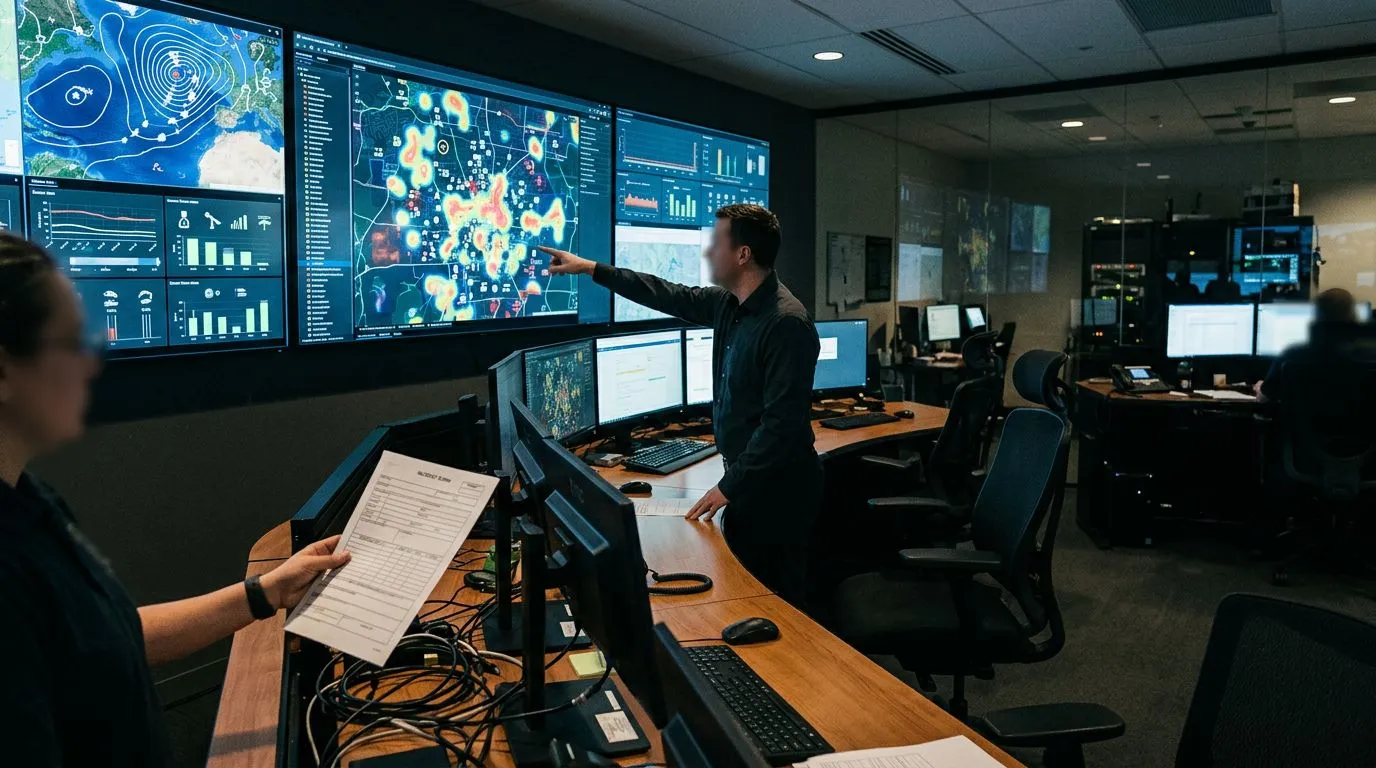
Control matters because disaster data is personal, operational and time-sensitive all at once. A report that includes a phone number, an address or a location pin may be useful for response, but the city still needs a clear purpose, limited access and proper retention rules. If data is copied across departments without a need, the system becomes harder to trust and easier to misuse.
Bad inputs create bad decisions. A delayed sensor update can make a road look safe when it is already under water, duplicated logs can make one incident look ten and an incorrectly tagged suburb can send a crew to the wrong side of the city. In practice, that means the city needs data quality checks, version control and a named owner for each feed, not just a colourful dashboard.
The strongest governance question is not whether AI can process more data, but who is allowed to see it, change it and override it. If eThekwini cannot explain access control, retention periods and audit trails in plain language, residents should assume the system is not ready for decisions that affect safety, travel and property.
How alerts and guidance should reach residents during an incident
- Official website and municipal notices
- SMS and mobile notifications where available
- Local radio and verified social media accounts
- Clear message content: location, hazard, timing, action to take
- Language accessibility and low-data access considerations
A useful municipal warning should tell you exactly where the problem is, what the hazard is, when it is expected to worsen and what you should do next. If the message does not name the area, the road, the river or the suburb, it is too vague to be useful, especially when residents are deciding whether to leave home, collect children or reroute a delivery vehicle.
The official website and municipal notices are the first place to check because they are the city’s own record, not a repost. SMS alerts and mobile notifications matter because they reach people who may not be browsing social platforms during a storm, while local radio still helps when data is patchy or power cuts interrupt normal routines. Verified social media accounts can add speed, but only if the post matches the official wording.
Language and access are not side issues. A warning that only works on a high-data app, or only in one language, leaves people out when timing matters most. For an eThekwini commuter, the best message is short enough to read quickly, plain enough to understand immediately and specific enough to act on without guessing.
How AI outputs must be checked before the city acts
AI output must be checked by a human before the city turns it into an instruction, because an emergency decision that affects roads, homes, schools or evacuation routes needs accountable oversight. In a properly run setup, a duty officer, disaster manager or incident commander reviews the machine’s recommendation, compares it with weather updates and field reports and decides whether to send the alert.
That human layer is what stops a false alarm from becoming a public mess. If a sensor contradicts a weather bulletin, or if a social media cluster shows the same flooded street from three angles while the model still reports low risk, the official on duty should escalate the case, not wait for the software to settle it. The city should also log who approved the message, what input triggered it and whether the final wording was changed.
Logging is not paperwork for its own sake. It lets the municipality audit mistakes later, which matters when residents ask why one area was warned and another was not. It also makes it easier to see whether the system is improving, or simply repeating the same false positives every time the weather turns.
This is where AI should stay inside a clear chain of command. It can suggest, rank and summarise, but it should not be the final authority on public safety. The city that gets this right will move faster without becoming reckless, and the city that gets it wrong will produce confident errors at scale.
What residents should expect from a local authority model
| Responsibility area | What a resident should receive | What channel should carry it | What must be confirmed by a human | What happens if the system fails |
|---|---|---|---|---|
| Flood risk monitoring | A warning tied to a named suburb, road, or river basin | Official website, SMS, radio, verified municipal accounts | That the area is genuinely at risk and the timing is current | The city falls back to manual alerts from duty officers |
| Road and transport disruption | A route closure, diversion, or safer alternative | Municipal notice and verified social post | That the route is blocked and the detour is open | Commuters are directed to the latest manual update |
| Resource deployment | Visible response such as crews, pumps, or barriers | On-the-ground action plus public update | That the right team and equipment were sent | The municipality prioritises the highest-risk incident manually |
| Public guidance | A clear action such as stay away, move vehicles, or prepare to evacuate | Short official message across channels | That the advice matches field conditions | Residents rely on the latest verified message rather than the tool |
A local authority model only earns trust when each responsibility area has a human-confirmed path and a fallback for when the system goes quiet. For residents, the test is straightforward: if a warning does not say who verified it, where it applies and what changed, it is not ready to shape your day.
This is where comparing it with City of Cape Town disaster management helps, not because the systems have to match exactly, but because the City of Cape Town already uses a public-facing disaster communications model that gives residents a clearer standard to judge. The benchmark is not a flashy model name, it is whether the city can move from monitoring to public instruction without making people guess what is official.
Why this matters before the next severe weather event
The time to prepare is now, because severe weather will not wait for you to save a contact list. If eThekwini improves AI-supported disaster management, the real benefit will be faster warnings and cleaner routing around flooded spots, but only for residents who already know which channels count and which ones to ignore. Save the municipality’s official disaster and SMS numbers, so you can check a warning quickly when the next storm hits.
- Save the official eThekwini Municipality channels now, including its website, verified social accounts, and any SMS alert service it offers, so you are not searching during a storm.
- Check which source your area uses for flood and road closure updates, because a suburb near a river may need different alerts from a commuter corridor or inland neighbourhood.
- Treat a municipal warning, a SAWS weather alert, and a personal social media post as different things, then act only on the official one if they disagree.
The practical question is not whether AI sounds impressive, but whether the city can prove its alerts are current, human-checked and easy to receive. If you live or travel through eThekwini, the rule is simple: follow the source that names the place, the hazard and the action, and ignore anything you cannot verify through official municipal or weather channels.
Frequently asked questions
How can I tell whether a flood message from eThekwini is official?
Check that it comes through an official municipal channel and that the wording matches on at least one other trusted source, such as the municipality’s website, verified social accounts, SMS alerts or a recognised local news relay. An official warning should name the place, the hazard and the action to take. If it is vague or only appears on one unverified post, treat it cautiously.
What should I do if an AI alert conflicts with what I see outside?
Take the more dangerous possibility seriously first, especially if the message points to flooding, a road closure or evacuation risk. If it is safe to do so, confirm the situation through official weather, traffic or municipal updates before moving. If there is immediate danger, act first and verify afterwards.
Will residents be able to opt out of data collection?
That depends on what data is collected, why the municipality needs it and the legal basis it relies on under POPIA. You should at least be told what personal data is held, how long it is kept and how it is used. For location, phone number or incident-report data, the city also needs a clear purpose and limited access.
Who is responsible if an automated warning is wrong?
The municipality remains responsible for the warning service, even if software helped produce the message. That is why a duty officer, disaster manager or incident commander must review important alerts before they go out. If the system fails, the city should fall back to manual alerts rather than letting the tool act alone.